How Contour Map Background Elevates Geographic Design and Visual Communication
Designers, educators, and content creators often face a common challenge: how to visually communicate geographic concepts, terrain data, or location-based ideas without resorting to clichéd maps or generic patterns. A Contour Map Background offers a sophisticated solution. This abstract design set uses topographic line patterns in earthy colors to create a modern, organic look that is both informative and aesthetically compelling. Whether you are working on a poster for a geography classroom, a digital infographic about elevation, or a brand identity for an outdoor-focused company, these backgrounds provide a ready-made foundation that saves time and elevates quality.
Understanding the Contour Map Background
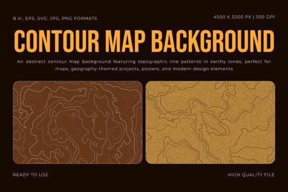
A Contour Map Background is more than just a decorative element. It replicates the visual language of topographic maps—those concentric lines that represent elevation changes on a terrain. By translating this scientific cartographic convention into a design asset, you gain a versatile tool that feels both familiar and fresh. The earthy color palette—often featuring browns, greens, ochres, and muted tans—anchors the design in nature, making it ideal for projects related to geography, travel, environmental science, or outdoor adventure.
This abstract set includes eight unique background designs, each offering a different configuration of lines, densities, and organic rhythms. The files come in AI, EPS, SVG, JPG, and PNG formats, ensuring compatibility with virtually any design workflow. At 4500 x 3000 pixels and 300 DPI, the resolution is print-ready for posters, banners, or high-quality digital displays. You can scale, recolor, or layer these patterns without worrying about pixelation or loss of detail.
Who Benefits from Using Topographic Line Patterns?
Different users approach a Contour Map Background with distinct goals. Understanding these perspectives helps you get the most out of the resource.
Educators and Curriculum Designers
If you teach geography, earth science, or environmental studies, you need visual aids that clearly demonstrate terrain concepts. A contour map background can serve as a base for diagrams showing elevation, slope, watersheds, or landform patterns. Instead of drawing lines from scratch, you can place labels, markers, or overlays on top of a ready-made topographic pattern. This saves preparation time and makes your handouts, slides, and posters look professional. The earthy colors also reduce visual fatigue during long classroom sessions.
Graphic and Web Designers
For designers working on branding, packaging, or web interfaces, a Contour Map Background offers a way to add texture and meaning without overwhelming the composition. You might use it as a subtle background for a landing page, a full-bleed poster for a travel company, or a pattern for an outdoor gear brochure. Because the lines are abstract, they don't compete with text or other graphic elements. You can also adjust opacity or blend modes to create soft, atmospheric effects. The SVG and EPS formats allow you to edit individual lines or colors in vector software, giving you full creative control.
Content Creators and Marketing Professionals
Infographics, social media visuals, and presentation decks often need a strong visual hook. A topographic line pattern immediately signals "geography," "exploration," or "data mapping." If you are producing content about climate change, urban planning, or hiking trails, a Contour Map Background reinforces your message instantly. You can combine it with charts, icons, or photographs to create layered, informative graphics that stand out in a feed or slide deck. The JPG and PNG versions are perfect for quick mockups or client presentations.
Practical Applications and Real-World Use Cases
Let's explore specific scenarios where a Contour Map Background can make a meaningful difference.
Geography-Themed Posters and Wall Art
Imagine designing a poster for a geography fair or a classroom map of a national park. Instead of using a generic gradient or solid color, you lay down a contour line pattern in warm earth tones. The pattern immediately communicates elevation and terrain. You can then overlay text, icons of mountains or rivers, and a compass rose. The result is an educational piece that is also visually engaging. Because the backgrounds are print-ready at 300 DPI, you can produce large-format posters without worrying about resolution.
Digital Maps and Interactive Graphics
For web-based projects, a Contour Map Background can serve as a base layer for interactive maps. You can use the SVG files to keep the pattern scalable and responsive. The lines provide a sense of depth and orientation, helping users understand the landscape before they click or zoom. You might also use a contour background in a presentation about GIS (geographic information systems) data, where the pattern reinforces the theme without distracting from the data points.
Branding for Outdoor and Environmental Organizations
A hiking club, a travel agency, or an environmental nonprofit needs a brand identity that feels grounded and authentic. A Contour Map Background can be incorporated into business cards, letterheads, or website headers. The earthy colors and organic lines evoke nature, adventure, and sustainability. You can even customize the pattern to match your brand palette. The vector formats make it easy to adjust colors and scale for different applications.
Educational Infographics and Workbooks
Teachers and instructional designers often create handouts that explain how to read topographic maps. By using a real contour pattern as the background, you can illustrate concepts like index contours, elevation intervals, and slope steepness. Students can trace the lines, mark points, or color-code elevation zones. The abstract nature of the background keeps the focus on the learning objectives, while the professional look adds credibility to the material.
Recommendations for Effective Use
To get the best results from a Contour Map Background, consider the following tips.
- Choose the right density. Some backgrounds have dense, tightly packed lines that work well as a subtle texture. Others have wider spacing that reads as a more prominent pattern. Match the density to your project's visual hierarchy. For text-heavy layouts, opt for lighter, more open patterns.
- Experiment with color. The earthy palette is designed to feel natural, but you can recolor the lines to fit your brand or mood. Use warm tones for a rustic look, cool tones for a modern feel, or monochrome for a minimalist approach. The AI and EPS files make recoloring simple.
- Layer with transparency. If you want the contour pattern to be a background element rather than the main focus, lower its opacity or use blending modes like Multiply or Overlay. This allows the pattern to add depth without competing with foreground content.
- Combine with other graphic elements. Topographic lines pair well with icons of trees, mountains, compasses, or data points. You can also overlay photographs of landscapes to create a composite that blends abstract and realistic visuals.
- Use the right file format. For print projects, use the 300 DPI JPG or PNG files. For editable vector work, choose AI or EPS. For web and screen use, SVG provides crisp, scalable results. Having all formats in one set is a major advantage.
Why These Backgrounds Solve Common Design Problems
One of the biggest pain points for designers is finding high-quality, print-ready patterns that don't look generic or pixelated. Stock photo sites often have low-resolution or poorly designed topographic patterns. A Contour Map Background from this set eliminates that problem. With 4500 x 3000 pixel resolution and 300 DPI, you can use these backgrounds for everything from business cards to large posters. The eight unique designs give you variety without overwhelming your choices.
Another challenge is versatility. You might need a background that works for both a digital slide deck and a printed brochure. Because the set includes both raster and vector formats, you can use the same pattern across multiple media without reworking the design. The earthy colors also bridge the gap between scientific accuracy and artistic appeal, making the backgrounds suitable for both educational and commercial projects.
Final Thoughts
A Contour Map Background is more than a decorative graphic. It is a functional design tool that communicates geography, terrain, and exploration in a visually refined way. Whether you are an educator creating classroom materials, a designer building a brand identity, or a marketer producing location-based content, these backgrounds offer a practical, ready-to-use solution. The combination of high resolution, multiple file formats, and earthy aesthetics ensures that your projects look polished and intentional. By integrating topographic line patterns into your work, you add depth, context, and a touch of cartographic elegance that resonates with audiences who value clarity and creativity.